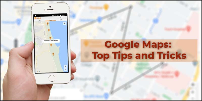
Google map is a fantastic tool. It is beneficial whether in your car or navigation or a never visited city. You can easily go from a to b. It also gathers information on the places that you are visiting. Google Maps also has some less known features that can be quite useful, especially if you do not know. In this article, we will see the five best tips and tricks of Google Maps. You will definitely learn something new.
Future Traffic
Everyone knows that Google Maps is a decent good satellite navigation system. It will tell you when there is heavy traffic. You can see it on the map. When it gets red, it means it has heavy traffic.
You can also plan ahead. You can look at the exact date and time you are going to be traveling and see the expected traffic. It will show any route that is better on the weekend or busier during a weekday.
- Open Google Maps
- Go to the Menu
- Click on the Traffic option.
- You can see live traffic now.
- Click on the Live traffic and change it to Typical traffic.
- Select your desired date and time.
You will see all the busy areas. It really does help if you are planning a trip and you need to be there by a certain time.
You will get some kind of info if you put in a start and endpoint. You can also use the live traffic option during navigation. You can start planning your trips with more precision.
Car Park Pin
This feature helps you a lot in several cases. Suppose you are somewhere where you have not been before or unfamiliar with that place, and you have parked up your car. You can instantly pin where you are parked. You can also add some other information. It is easy to find your way back.
- Go to Google Maps.
- Tap on the Blue dot.
- Click save your parking.
When you click on save your parking, it will put a pin exactly where you have placed it. At the bottom of the screen, you will see more info. You can put in extra information by clicking this button. You can also add duration for the remaining parking time and add some photos. When you are back in the place, tap on the pin and select the clear option. You can also share your parked location with your contacts. It is a really cool feature.
Location Sharing
It is probably the well-known feature of Google Maps. There are a couple of messaging apps where you can directly share your location. If you want to share your location through Google Maps, you can do that too.
- Go to the menu.
- Click Location Sharing
- Select the share location option.
- Share the app or contacts.
This is the way to share location through Google Maps. You can also choose a duration to share your location. There is also a physically turn-it-off option. It is best for safety purposes and a simpler way of telling people exactly where you are.
Custom Lists
Google Maps is used a lot for planning visits. This is a really good gesture of the maps if you want to plan places to visit. You are not required to write them down separately. You will get all the information on Maps.
It is publicly shareable, which means you can share any created list publicly. You can share it with friends or the public.
- Open the Google Maps.
- Go on to Menu
- Click on Your Places.
- Select the saved option. You will get three default options.
- Click on the + icon to create a custom list.
- Select Create option. You can also add descriptions on the created list.
- Click on add places to add different places for the list.
- Click on any place available on Google Maps.
- Select the Save option
- Add this place to your desired list.
Measure Distance
Google maps has a feature called the measuring distance tool. You can use this feature for measuring running distance. If you are going for a run and want to plan a specific distance, you can use this feature. Google maps will help you to get from A to B; it will show you the route. It may not be the route you want to take.
You can go for a random run or walk. There is an option for this in Google Maps
- Open Google Maps
- Drop the pin at the starting point.
- Select the Measure Distance option from the drop-down menu.
- It will start the feature.
- Select the endpoint on Google Maps.
You can choose several endpoints to change the direction or route. The total distance will be displayed at the bottom of the screen. You can use this feature for finding running or walking routes.
Conclusion
We use it daily for navigation or finding our way. These tips and tricks will make you a Google Maps Ninja. There are a lot of cool features in Google Maps, but these are the ones that are very useful for you.
source: google-maps-top-tips-and-tricks


QuickBooks Support Phone NumberQuickBooks is an accounting software package developed and marketed by Intuit.

The popularity of personal navigation devices as well as mapping services, for example, Google Maps in both internet and mobile versions has made many parts of society used to certain location-based ideas and their utilization.Without the input of location data these days, no mobile experience is complete.
Below mentioned are key aspects and ways to effectively leverage LBS (Location Based Services) for any business.Localized Search: Local search is the use of specialized Internet search engines that allow users to submit geographically constrained searches against a structured database of local business listings.
Typical local search queries include not only information about "what" the site visitor is searching for (such as keywords, a business category, or the name of a consumer product) but also "where" information, such as a street address, city name, postal code, or geographic coordinates like latitude and longitude.City Guides: The increase in the use of mobile phones has made it easier to provide different applications available to the users `on the go'.
Effective task management requires managing all aspects of a task, including its status, priority, time, human and financial resources assignments, recurrence, dependency, notifications and so on.
GPS or Global Positioning System is a satellite navigation system that furnishes location and time information in all climate conditions to the user.
to provide the best possible route.Delivery Scheduling: Delivery schedule is a business metric used to calculate the timeliness of deliveries from suppliers.

Recently Google has added a new feature in Google Maps, which is known as the “Covid-19 layer,” and now Google is all set to launch a new care mode UI for Google Maps.
The new interface will introduce big buttons in the app.
Similarly, on the right-hand side, you get a menu button/ home button that will launch a new screen, which will include all the essential apps of your phone like calls app, messages app, Spotify app, YouTube Music app, etc.Right above it, you will see the music playback controls in the app.
When you tap on the menu button and click on the icons, you will see their respective screen along with large UI buttons and cards on your mobile.The new car mode Ui is very similar to Android Auto phone UI.
But it’s not entirely identical to Android Auto navigation UI (Which is going to be replaced by the “Assistant Driving mode” in the near future).The new car mode UI is currently in beta testing and is available to only a few Google Map users.
So, if you haven’t received the new car mode UI on your Google Maps app, then you will have to wait a little bit longer to get your hands on it.Our ViewGoogle is working day and night to add lots of unique features for Android users to make their life more comfortable during this COVID-19 epidemic.

Google My Business is now introducing new performance reports that users can access within GMB under the “Insights” section.
There have been numerous hints about the launch of these reports, once in August and then last month again.
However, now the platform has officially rolled it out to the public.
However, as of now, users might notice a notification that says, “Your insights are moving…” at the top of the page, and right below that notification, there will be a “See new profile performance.” Click on it to access your new performance report.WHAT METRICS DO THE NEW PERFORMANCE REPORTS SHOW?
Data will remain available for up to six months, and users can review their performance by selecting custom time frames.At the bottom, the reports display what searches the searchers performed in Google Search and Google Maps to trigger your Google My Business listing under the “How people discovered you” section.Nevertheless, the new reports are missing metrics like the total number of website clicks, and driving directions started.
Unlike the current Google Insights report, the new performance reports don’t display whether the users discovered your business listing on Google Search or Google Maps.

Increasing eCommerce store's sales is the ultimate purpose of every online merchant.
To do so, it's essential to provide customers with convenience and excellent shopping experience.
A store locator is one such feature that boosts the store's sales as it helps customers find the nearest store.
Magento 2 store locator by FME offers advanced features that benefit both admins & customers.
It allows Merchants to add an unlimited number of physical stores with all the relevant details with clear directions on Google maps.
Customers can view all the store's details including the store's title, address, contacts, working hours, holidays, available products etc.